Gosaikunda
Difficulty
Medium
Duration
7-9 Days
Max Elevation
4380m
Views
66
Starting Point
Gosaikunda
Sacred Alpine Lake in the Langtang Region
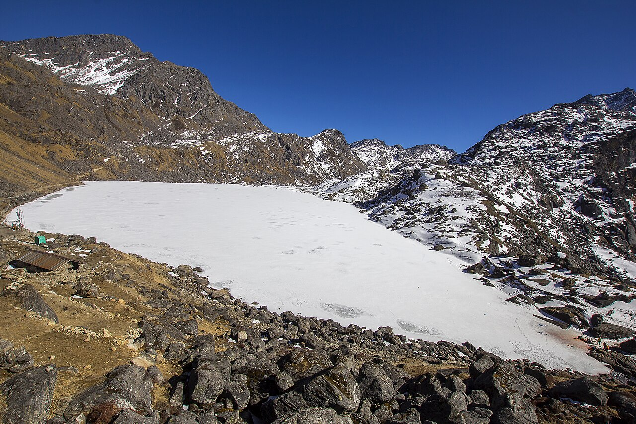
Gosaikunda, situated at an altitude of 4,380 meters (14,370 feet), is a revered high-altitude lake nestled in the Rasuwa District of Nepal’s Langtang region. Legend has it that Lord Shiva created the lake by piercing the ground with his trident to quench his thirst after consuming poison during the churning of the ocean (Samudra Manthan). This makes Gosaikunda one of the holiest pilgrimage sites for Hindus and Buddhists alike.
Trekking Through Diverse Landscapes
The journey to Gosaikunda typically begins in Syabrubesi or Dhunche and winds through lush rhododendron forests, terraced hillsides, and traditional Tamang villages. Trekkers are rewarded with panoramic views of snow capped peaks like Langtang Lirung, Ganesh Himal, and Manaslu. The trail passes through Lauribina Yak and other small settlements before reaching the serene turquoise waters of Gosaikunda, surrounded by rugged mountain terrain.
Best Time to Visit and Cultural Significance
While the trek can be undertaken from March to May and September to November, the most auspicious time is during the Janai Purnima festival in August, when thousands of pilgrims gather to bathe in the sacred waters. The atmosphere becomes vibrant with rituals, chants, and communal devotion. Outside the monsoon season, the skies are clear, offering excellent visibility and comfortable trekking conditions.
Elevation Profile
Trail Roadmap
Gallery Plates for Gosaikunda
15 items
Gosaikunda
© Saroj Pandey

Gosaikunda
© Felix Dance

Gosaikunda
© Balaram Ghimire/TKP

Gosaikunda
© Balaram Ghimire/TKP

Gosaikunda
© Mohan K Dulal/Wikimedia Commons

Gosaikunda
© Balaram Ghimire/TKP

Gosaikunda
© KMG

Syafru
© Niraj Joshi

Syafru
© Niraj Joshi

Lama Jungle View
© Remi Zouk

Lama Hotel
© Ildefonso Muñoz

Wooden Bridge
© Gopal Gurung

Lama Hotel (2420m)
© Rajaram Pakur

Lama Hotel (2420m)
© Deepa Maharjan

Sing Gompa (Chandanbari)
© Safal Silwal